Lone Pine is a tiny town with one main drag mainly frequented by RVing seniors, gold-panning tourists and truckers. It's near the foothills of the eastern side of the Sierra Nevadas, the Alabama Hills. These hills were an old gold-prospecting haunt, and were used in the 1930s and 1940s as settings for the John Wayne cowboy and the British-Army-in-India movies. 25 minutes up the mountains is the Mt Whitney Portal waterfall and an assortment of camping and hiking activities.
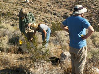
We were in the area to survey utility poles that are planned for repair. Basically, the archaeologists walk in transects within 30 meters of the utility towers and look for any archaeological resources that might be affected by the construction. The Owens Valley, which includes Lone Pine and was the location of the several hundreds of miles of utility line, is home to some pretty interesting archaeology. There's an obsidian source in the Coso Mountains, to the east side of Owens Valley, and the prehistoric remains we've found include flakes, milling surfaces on local bedrock, and some pottery. Most of the historic artifacts we've found have indicated temporary camps (often by the workers in the 1920s who built the utility line initially). Most of what we find is canned veggies and meat, condensed milk, tobacco, and lots and lots of alcohol. I think there's a lot of irony in charging Southern California Edison so the trash left by their predesessors can be archaeologically recorded, but as long as artifacts are over 50 years old, they are considered to be potentially of archaeological significance.
There's a lot to be said for spending one's work week walking around looking at magnificent vistas, especially since the temperature up there finally dropped below 100F this week. We've been starting work at about 5:30 every morning, and drive to the jobsite in the pre-dawn dark. Then, as we work on the first tower of the day, we watch the sun come up over the Coso Mountains and hit the Sierras!
The somewhat drab Coso Mountains:

A view facing north of our lovely line of utility poles:

Elliott, Josh, and Julie check a boulder for milling slicks left by Native Americans:

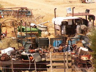
Junkyard right beside one of our sites:

 On Thursday before we left, Elliott and I journeyed up to the Mount Whitney portal area and waterfall. The view of the peak from the foothills:
 We stopped at a turnout to take pictures and stretch our legs:

 Finally, the waterfall:


